Meghalaya Waterfall 
Meghalaya – The Abode of Clouds and Rain
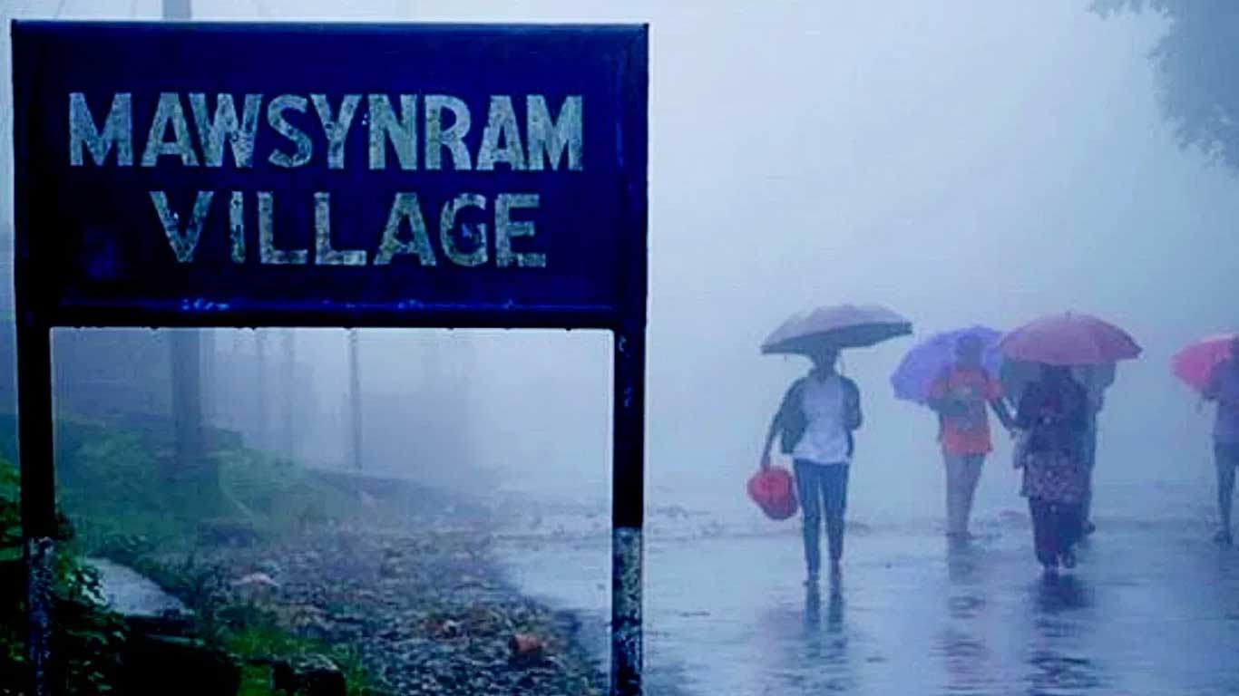
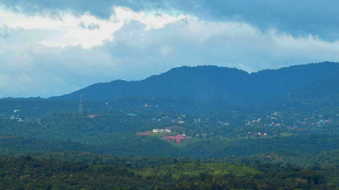
Meghalaya literally means “the abode of the cloud, and few places in India live up to their name as dramatically as this hill state in the North East. The vast rain-bearing clouds that rise from the Bay of Bengal travel across the heated plains of Bangladesh and enter India through Meghalaya. As they hit the elevated Shillong Plateau and the Garo, Khasi and Jaintia Hills, the sudden drop in temperature causes intense condensation, resulting in some of the heaviest rainfall on Earth. In pockets such as Mawsynram and Cherrapunji, average annual rainfall can cross 11,000–12,000 mm, earning Meghalaya a permanent place among the wettest inhabited regions of the planet.
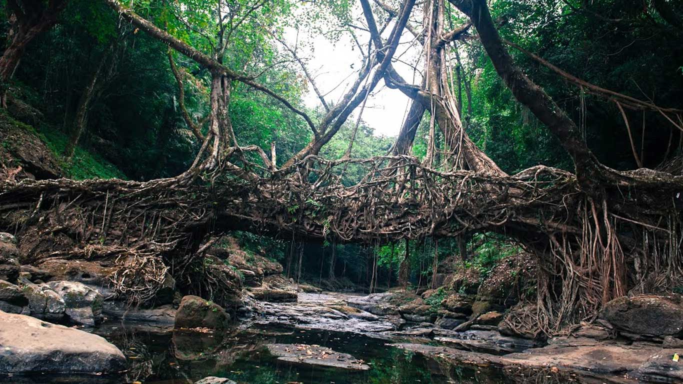
Yet, reducing Meghalaya to just rain would be unfair. This is a state of dramatic landscapes, living root bridges, limestone caves, sacred forests, vibrant indigenous cultures and slow, soulful travel. For travellers looking beyond mainstream hill stations, Meghalaya offers depth, diversity and a rare sense of balance between nature and human life.
Geography and the Seven Sisters Context
Meghalaya is one of the famed Seven Sister States of North East India and shares its borders with Assam to the north and east, and Bangladesh to the south and west. Despite being a relatively small state, its terrain is varied and layered. Meghalaya is broadly divided into three physiographic regions, each with its own identity.
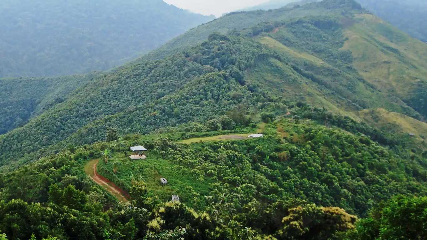
The Garo Hills occupy the western part of the state and are further divided into five districts. This region is less explored by mainstream tourism but is rich in forests, wildlife and tribal heritage. The central part of Meghalaya is formed by the Khasi Hills, divided into four districts, and this is where most of the state’s tourism activity currently concentrates. To the east lie the Jaintia Hills, comprising two districts, known for their river valleys, caves, traditional markets and proximity to the Bangladesh border.
Although Meghalaya officially has 11 districts today, tourism is still largely limited to East Khasi Hills and parts of West Jaintia Hills. The remaining districts have immense untapped potential and are slowly beginning to attract travellers interested in offbeat routes and community-based tourism.
Shillong – The Cultural and Tourism Hub
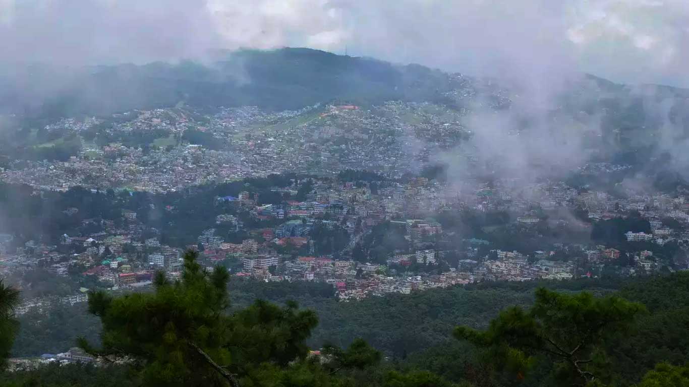
Shillong, the capital of Meghalaya, is located in the East Khasi Hills, not far from the Assam border. Often called the “Scotland of the East”, Shillong’s rolling hills, pine forests and colonial-era charm have made it the natural gateway to the state. While the nickname may feel dated, the city’s cultural life, music scene and café culture give it a character that is uniquely its own.
Shillong functions as the base for most Meghalaya sightseeing tours. From here, destinations like Cherrapunji, Mawsynram, Dawki, Jowai and Mawlynnong are all within a two to four-hour drive, making the city ideal for travellers who prefer one central stay with multiple day excursions. Hotels in Shillong range from heritage properties and boutique stays to modern mid-range hotels, making it suitable for a wide spectrum of travellers.
Cherrapunji, Mawsynram, Dawki and Jowai – The Classic Circuit
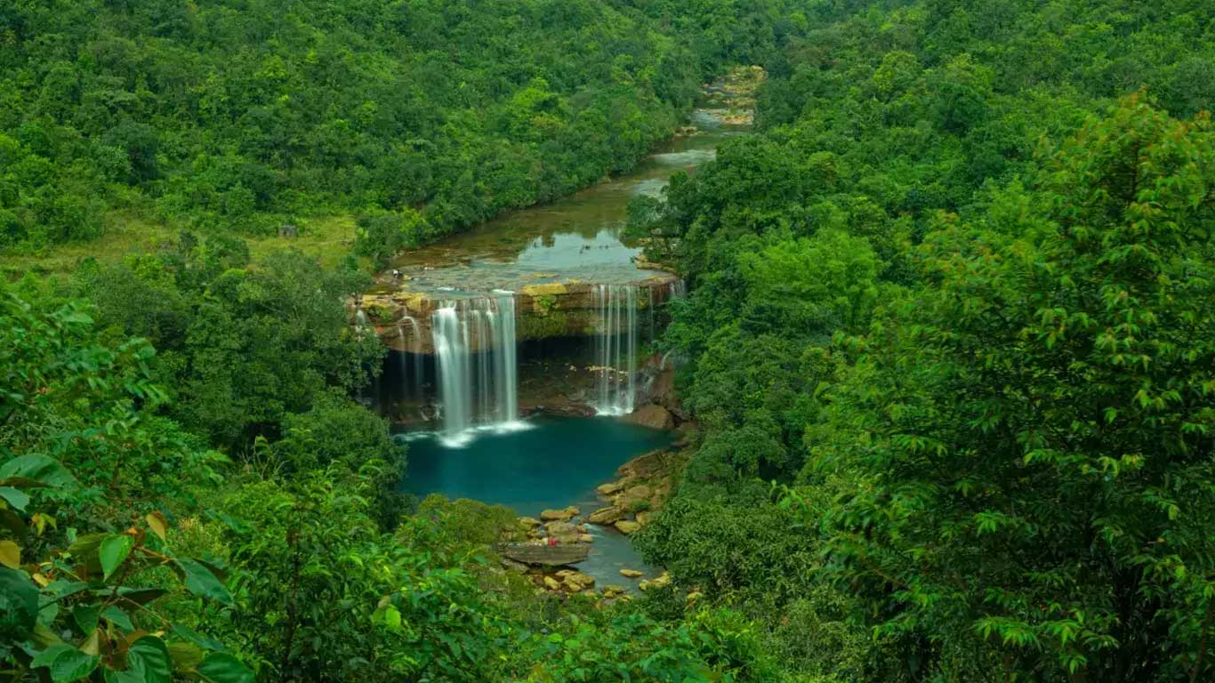
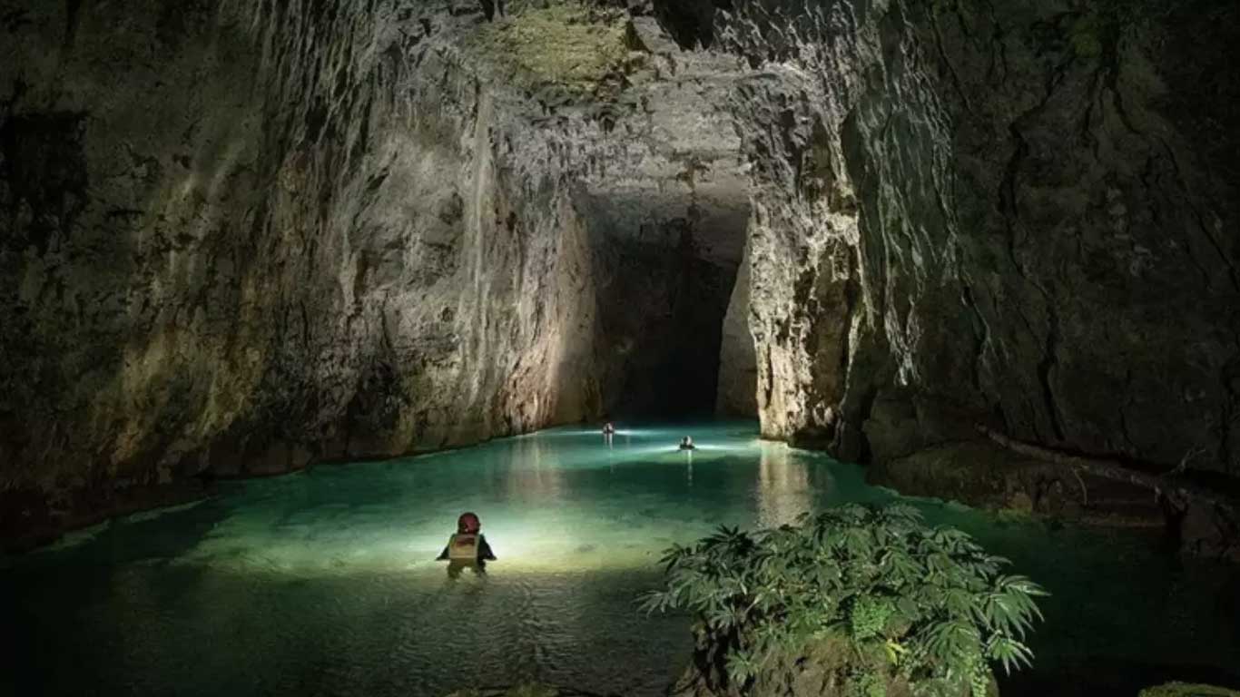
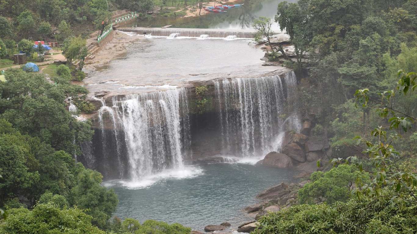
Just south of Shillong lies Cherrapunji, historically famous for its rainfall records and dramatic escarpments overlooking the plains of Bangladesh. Today, travellers come here for waterfalls, living root bridges, limestone caves and cloud-filled valleys. Nearby Mawsynram, officially recognised as the wettest place on Earth, offers a quieter alternative with equally striking landscapes.
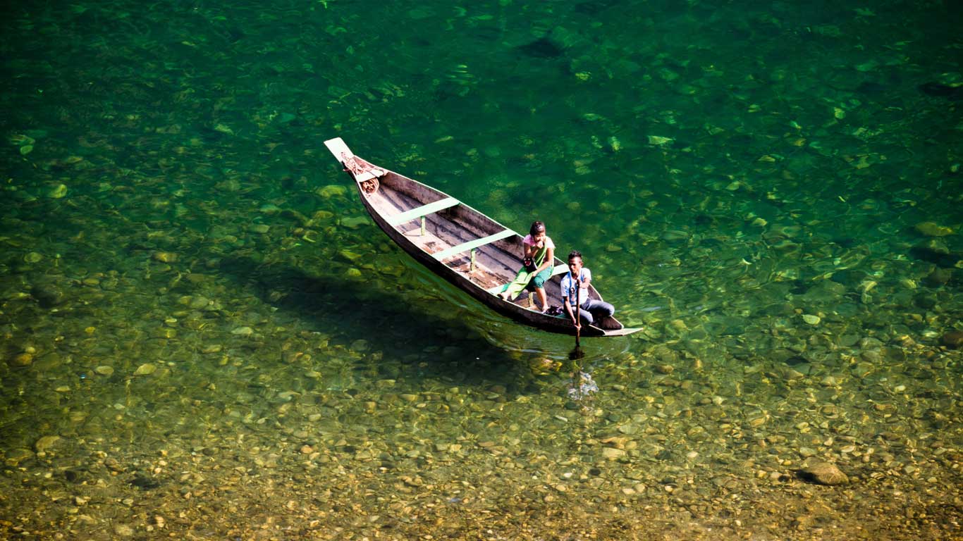
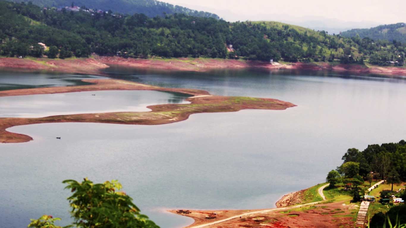
Further east, Dawki sits on the India–Bangladesh border and is best known for the Umngot River, whose crystal-clear waters make boats appear as if they are floating in mid-air during the winter months. The town is also an important trade point, adding a layer of everyday life to its scenic appeal. Jowai, in the Jaintia Hills, offers a slower, more cultural experience with river viewpoints, traditional markets and access to lesser-known caves and waterfalls.
Most Meghalaya tour packages naturally combine these destinations, and when planned well, they offer a balanced mix of nature, culture and relaxed travel.
People, Culture and Language
Meghalaya has a population of around 3.5 million, and evidence suggests human habitation here since the Neolithic age. About 83 per cent of the population consists of indigenous communities, primarily the Khasi, Garo and Jaintia tribes. One of the most distinctive aspects of these societies is the matrilineal system, where lineage and inheritance pass through the female line, a feature that often fascinates visitors.
Christianity is the dominant religion, followed by nearly 75 per cent of the population, though indigenous beliefs continue to coexist, especially in rural areas. English is the official language and is widely spoken, making communication relatively easy for domestic and international travellers. Bengali, Nepali and several smaller tribal communities also form part of the state’s social fabric, adding to its diversity.
Weather in Meghalaya – Understanding the Seasons
Meghalaya’s weather plays a defining role in travel planning. Summer, from March to early June, is mild and pleasant, with temperatures generally ranging between 15 and 25 degrees Celsius. This is a popular time for sightseeing, as the weather remains comfortable without heavy rainfall.
The monsoon arrives by June and continues till September. This is when Meghalaya transforms into a lush, rain-soaked paradise. Waterfalls are at their peak, rivers swell dramatically, and forests appear almost unreal in their greenness. However, heavy rain can disrupt road travel and visibility, so itineraries need flexibility.
Winter, from November to February, is cool and dry. Temperatures can drop below 10 degrees Celsius in higher areas, especially at night. This is the best season for clear views, photography and river activities like boating at Dawki.
How to Reach Meghalaya
Meghalaya has limited rail connectivity within the state. Mendipathar, on the Meghalaya–Assam border, is currently the only railway station, and even that sees limited services. For most travellers, Guwahati in Assam acts as the primary rail and air gateway.
Guwahati Airport is well-connected to major Indian cities and serves as the most reliable entry point. Shillong has its own airport at Umroi, now officially named Shillong Airport, with improved but still limited flight connectivity. Guwahati is about 105 kilometres from Shillong, and the drive typically takes around three hours, depending on traffic and weather.
From Guwahati, travellers can hire private taxis or opt for organised transfers as part of Meghalaya tour packages.
Tourism Today and Emerging Experiences
While Shillong, Cherrapunji and Dawki remain the most visited destinations, Meghalaya tourism is slowly expanding into lesser-known regions. Community-run homestays, village walks, cave exploration and forest-based experiences are gaining popularity among travellers seeking authenticity. Sustainable tourism practices are increasingly encouraged by both local communities and responsible tour operators.
Hotels and resorts are improving steadily, though the state still prioritises low-impact tourism over large-scale development. This makes Meghalaya particularly attractive for travellers who value nature, culture and meaningful experiences over luxury alone.
Meghalaya Travel FAQs
How many days are ideal for a Meghalaya trip?
A well-paced Meghalaya itinerary usually requires seven to ten days to cover Shillong, Cherrapunji, Dawki and Jowai comfortably.
Is Meghalaya safe for tourists?
Yes, Meghalaya is considered safe for tourists, including solo travellers, provided basic travel precautions are followed.
What is the best time to visit Meghalaya?
October to April is ideal for most travellers, while monsoon lovers may prefer June to September for lush scenery.
Are hotels easily available across Meghalaya?
Hotels are widely available in Shillong and Cherrapunji. In remote areas, homestays are more common and often offer a richer experience.
Can Meghalaya be visited with family?
Absolutely. Meghalaya suits families, couples and senior travellers, though road journeys can be long and winding.
Plan Your Meghalaya Journey with NBTT
Meghalaya rewards travellers who approach it with time, curiosity and good local guidance. Whether you are planning a classic Shillong–Cherrapunji–Dawki circuit or looking to explore offbeat districts beyond the usual map, professional planning makes all the difference.
NBTT Travel Solution Private Limited specialises in curated North East India tour packages with deep regional knowledge. From comfortable transport and handpicked hotels to flexible sightseeing plans and authentic local experiences, NBTT ensures your Meghalaya journey is smooth, insightful and memorable.
For customised Meghalaya tour packages, expert travel advice and reliable on-ground support, connect with NBTT Travel Solution Private Limited at +919733300696 and explore the true abode of clouds with confidence.
East Himalaya
-
Address:NBTT Travel Solution Private Limited, 19, MN Sarkar Road, Sevoke More Siliguri, State : West Bengal, Country : India. PIN : 734001
-
Call Us at:
+91-9733300696 -
Mail Us:
info@east-himalaya.com